French maritime areas
This theme brings together information on maritime delimitations: straight baselines ; outer limits of the territorial sea (12 nautical miles) ; outer limits of the contiguous zone (24 nautical miles) ; outer limits of the exclusive economic zone (200 nautical miles), limits resulting from agreements with neighbouring States and French maritime spaces governed by the United Nations Convention on the Law of the Sea.
This page is the reference medium for the State's communication on maritime spaces under French sovereignty or jurisdiction.
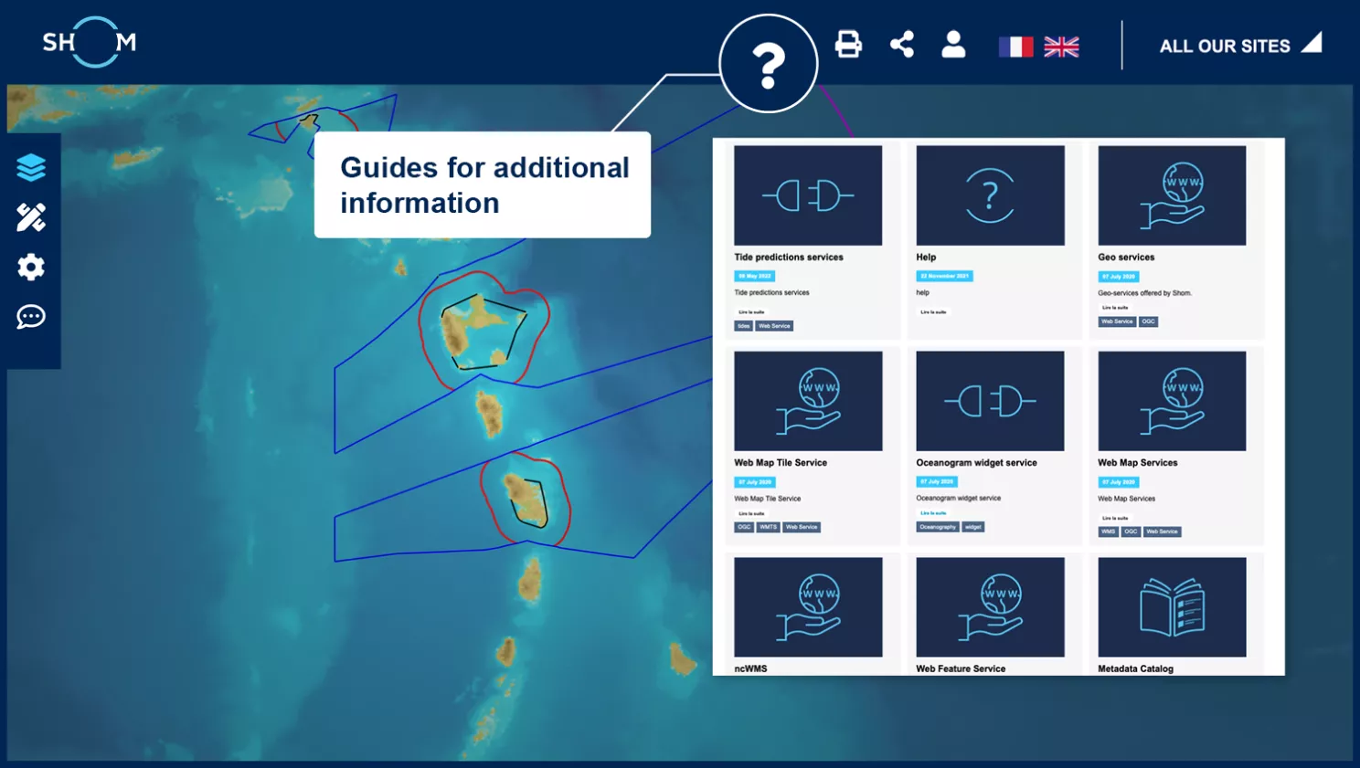
Map viewer
data.shom.fr
Access to data information
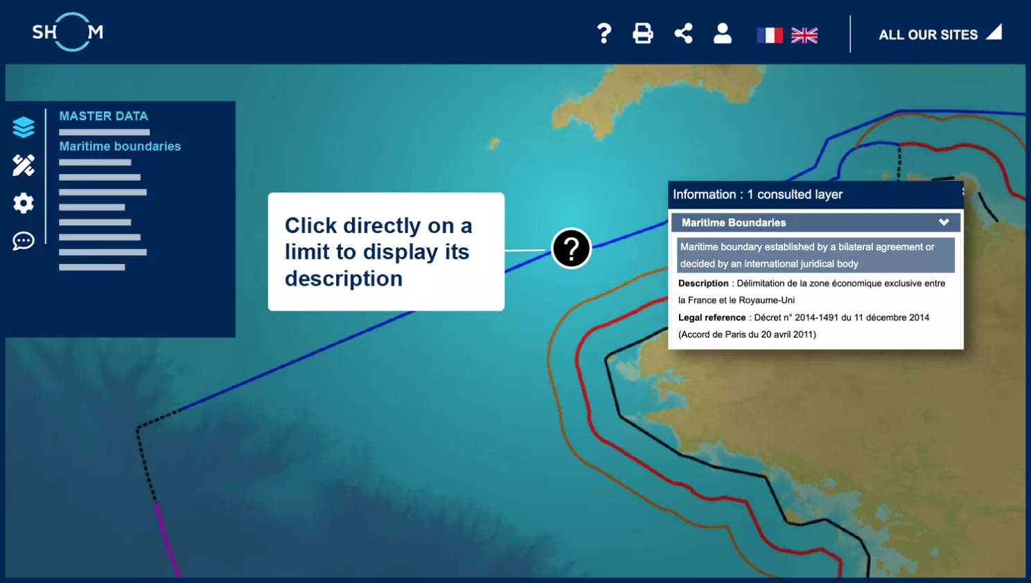
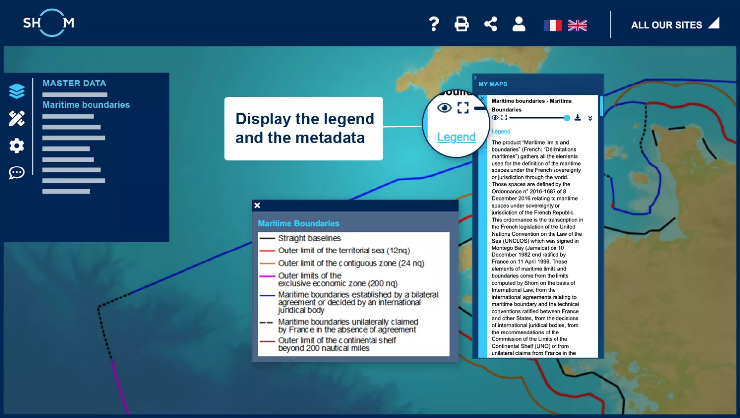
Access to metadata and legend
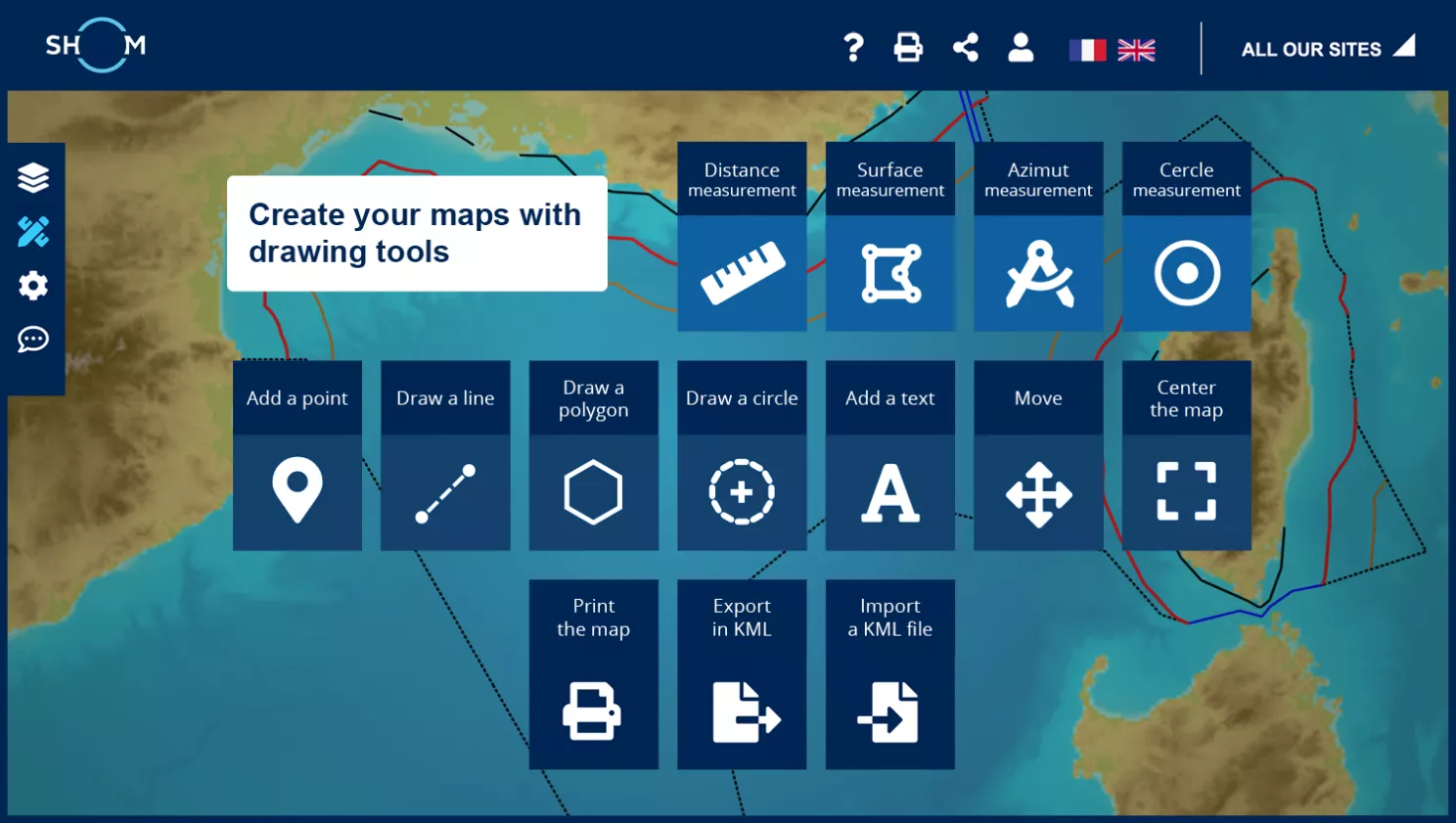
Composing your maps with the drawing tools
data.shom.fr
Maritime limits and boundaries
| Referent | MEAE (Ministry for Europe and Foreign Affairs) |
|---|---|
| Producer | Shom |
| Data provider | data.shom.fr |
| Metadata | BDML_DELMAR.xml |
| Geo services | https://services.data.shom.fr/DELMAR/wfs https://services.data.shom.fr/DELMAR/wms/v |
| Downloading | DELMAR.ZIP |
| Constraints | Do not use for navigation - Free use provided that sources are cited. Open Licence (version 2.0 of April 2017), defined by the Etalab mission |
Sovereignty and jurisdiction maritime spaces of France
| Referent | MEAE (Ministry for Europe and Foreign Affairs) |
|---|---|
| Producer | Shom |
| Data provider | data.shom.fr |
| Metadata | BDML_ESPACES_MARITIMES.xml |
| Geo services | https://services.data.shom.fr/DELMAR/wfs https://services.data.shom.fr/DELMAR/wms/v |
| Downloading | ESPACES_MARITIMES.7z |
| Constraints | Do not use for navigation - Free use provided that sources are cited. Open Licence (version 2.0 of April 2017), defined by the Etalab mission |
Metropolitan France
Saint-Pierre-and-Miquelon
French Antilles
French Guiana
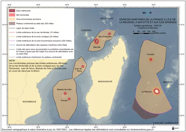
La Réunion
Mayotte
Scattered Islands (Tromelin Island, Glorioso Islands, Juan de Nova Island, Bassas de India and Europa Island)
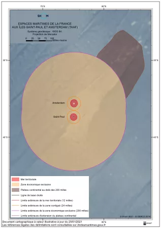
Saint-Paul Island
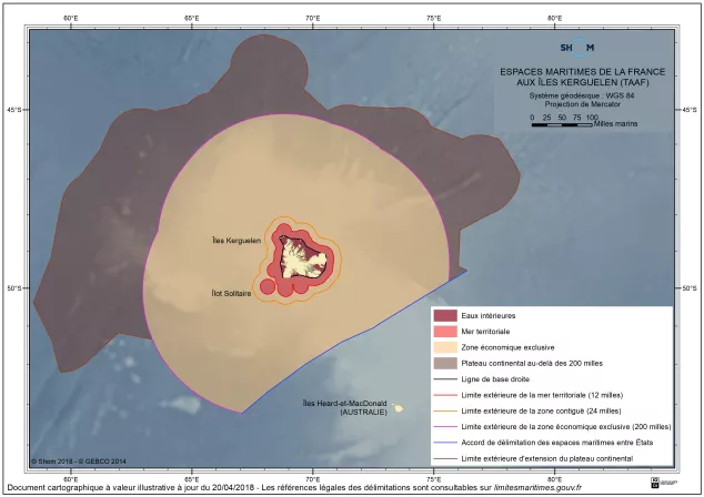
Kerguelen islands
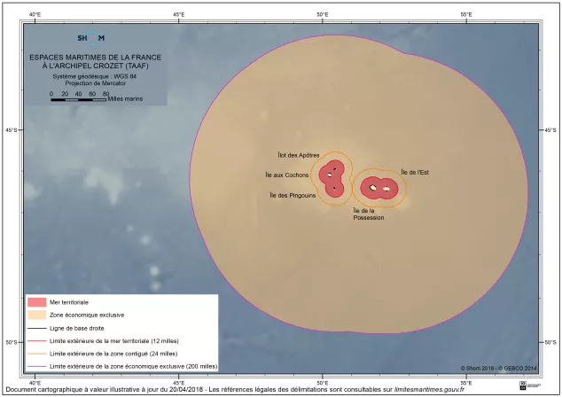
Archipelago of Crozet
Wallis-and-Futuna
New-Caledonia
French Polynesia
Clipperton Island
You can download 15 free maps showing the maritime areas under French sovereignty or jurisdiction, as well as detailed information for each territory. These maps show the extent of the maritime areas in force and their limits.
Please note: These graphic documents are for illustrative purposes only. Depending on requirements, it is necessary to refer to the legal references or to the digital data.
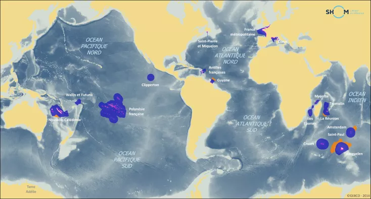
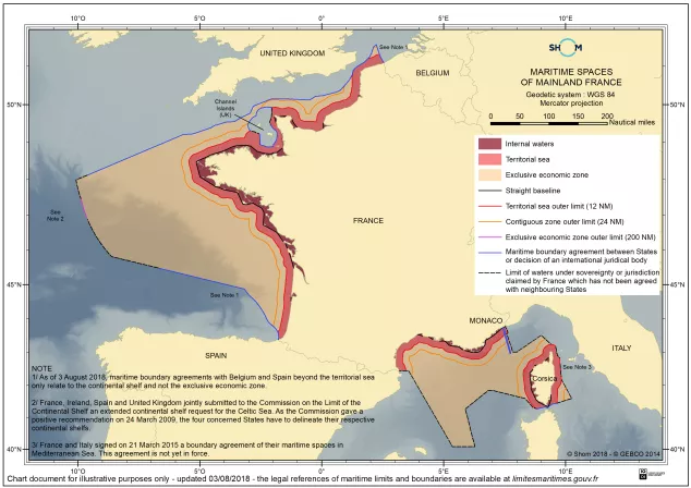
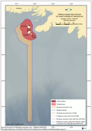
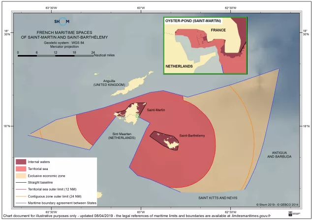
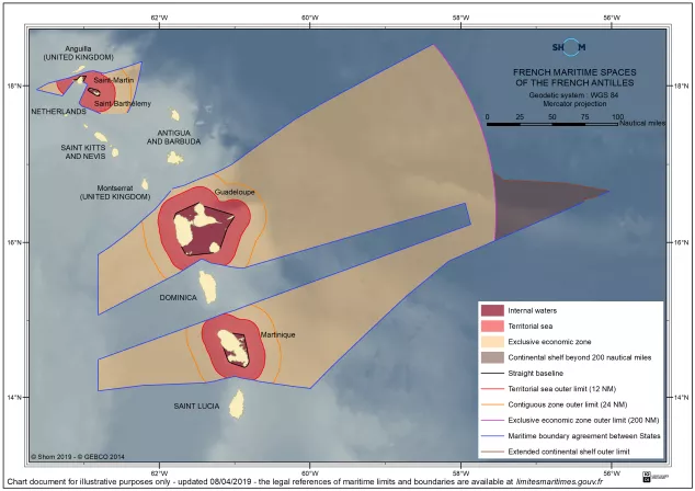
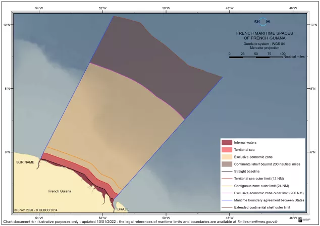
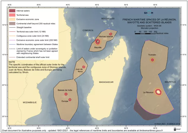

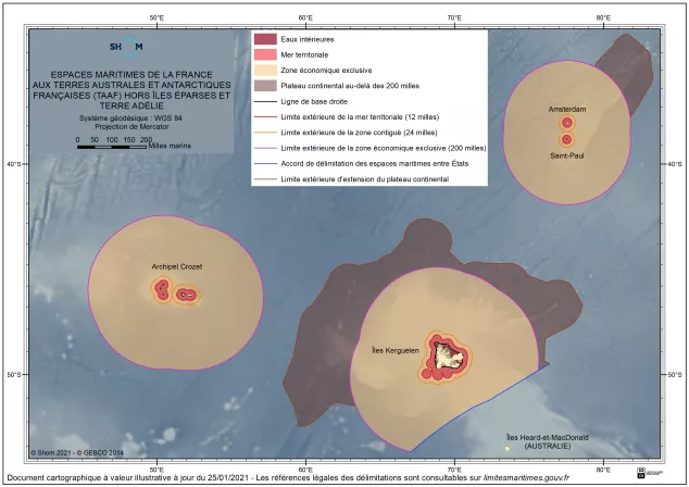
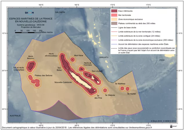
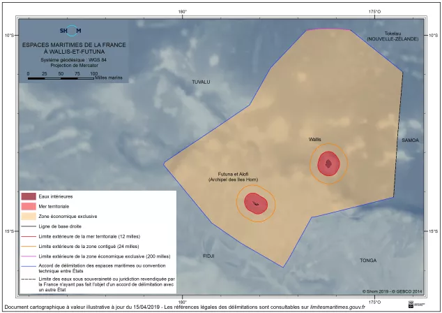
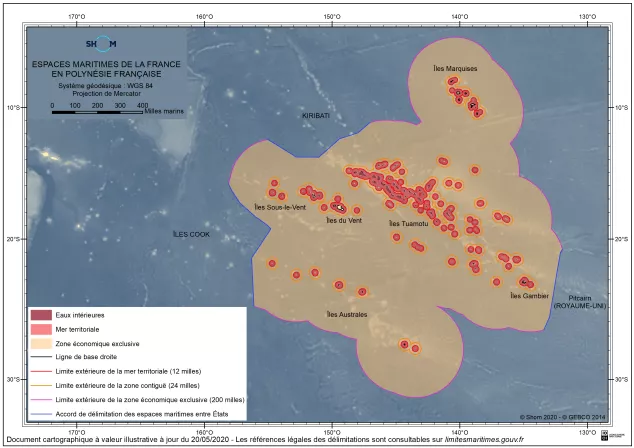
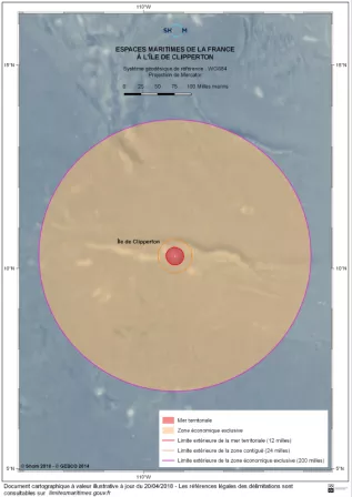
Calculations performed on the basis of current knowledge of French maritime boundaries on January the 25th january . These figures are subject to change, depending on the boundary agreements signed and updating of outer limits of the maritime space resulting from Shom calculations.
- Background and history of maritime delimitation data
- Stakeholders and the process of defining French maritime spaces
- Methods of delimiting French maritime areas
- Additional information on the continental shelf
- Data at European level (note that this data is not based on the official French maritime limits)
- Data at world level (note that this data is not based on the official French maritime limits)